Multi-Scale Experimental-Numerical Analysis of Sand Deformation
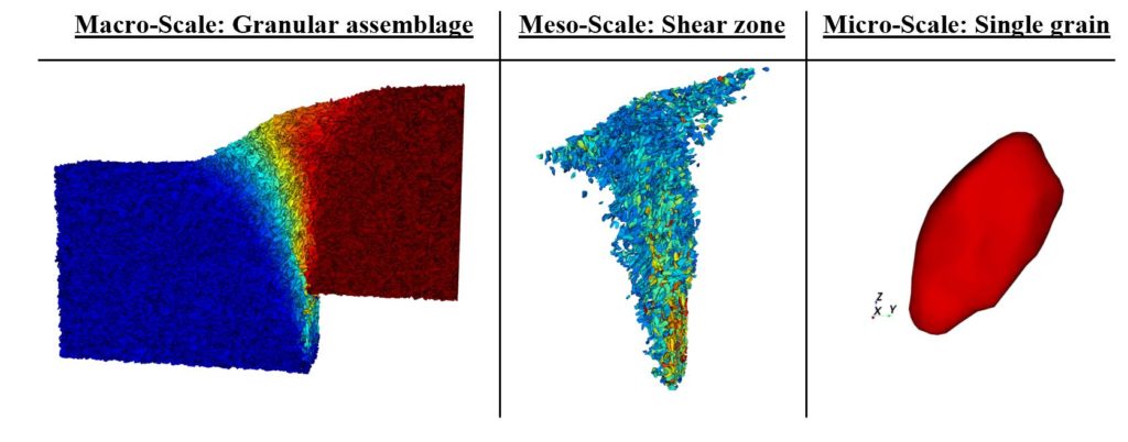
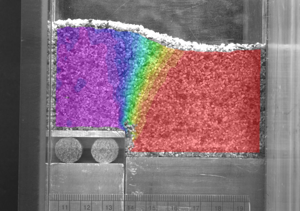
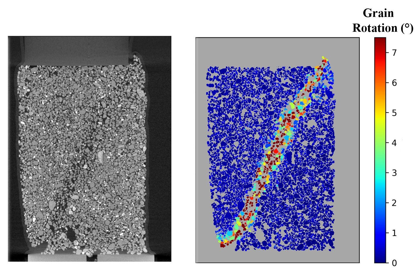
This project explores the development of a shear zone from the individual grains to the collective macroscopic deformations in a series of quasi-static base-offset experiments with a uniform sand. The macroscopic strains and displacements developing within the sand medium are calculated using digital image correlation. Analogous distinct element simulations are produced based on the boundary conditions of these experiments while capturing the exact morphologies of the grains used in the experiments. The sand pluviation routine used in experiments is reproduced numerically to produce consistent grain orientations as in the experiments, and a suite of simulations are performed to compare the range of numerical results with the range of experimental results. The motions of individual grains within the developing shear zone are analyzed throughout the deformation process, and the meso-scale development of the shear zone itself is tracked separately from the rest of the sand medium. The comparison of experiments and simulations relies on two-dimensional image data, which is often the best available imaging in scenarios involving terrain that is difficult to access on our own planet and others. This project explores ways in which physically accurate simulations may be produced based on two-dimensional image data and provides a methodology for understanding granular materials that we cannot yet retrieve physically yet can model numerically.
3-D X-Ray Computed Tomography Analysis of Naturally Deposited Sands
Naturally deposited sands often exhibit a well-structured fabric that is difficult if not impossible to reproduce through anthropogenic means, e.g., in a laboratory setting. Traditional soil strength tests can uncover how unique fabrics affect bulk soil behavior, yet they cannot quantify the fabric itself. Advanced imaging techniques such as X-Ray Computed Tomography (XRCT) provide the insight that traditional soil strength tests cannot provide on their own. This project combines triaxial testing with three dimensional XRCT to quantify the fabric parameters that influence the strength and deformation behavior of naturally deposited samples.
Distinct Element Analysis of Fault Rupture-Soil-Foundation Interaction
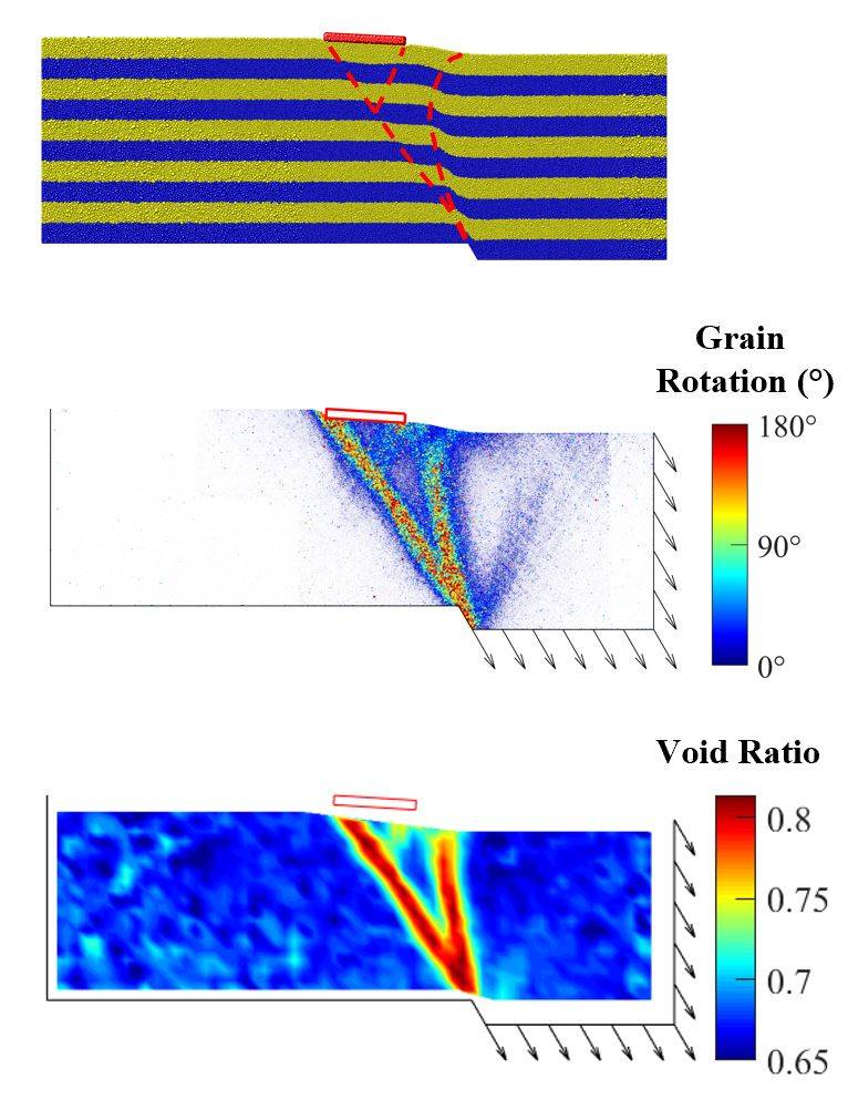
The distinct element method (DEM) is growing in popularity for soil-structure interaction problems due to its ability to capture large-strain shear deformations while allowing for the structure to detach and move as an independent body all without modification to the method’s calculation sequence. This project analyzes earthquake fault rupture-soil-foundation interaction (FR-SFI) using DEM in three dimensions with over 1 million irregularly-shaped grains. The challenge of computational intensity with millions of individual grains in DEM simulations is overcome with high-performance computing. DEM simulations are made analogous to physical experiments having the same boundary conditions, and the results of the simulations are shown to match the physical experiments quite closely. Micromechanical analyses of grain rotations, grain-to-grain contacts, and void ratio distributions provide key insight into the mechanisms of FR-SFI that develop with different types of foundations located at different positions relative to the bedrock fault. This project provides a methodology for analyzing other soil-structure interaction problems with DEM so that grain-scale mechanisms may be uncovered that cannot be elucidated with continuum-based numerical methods.
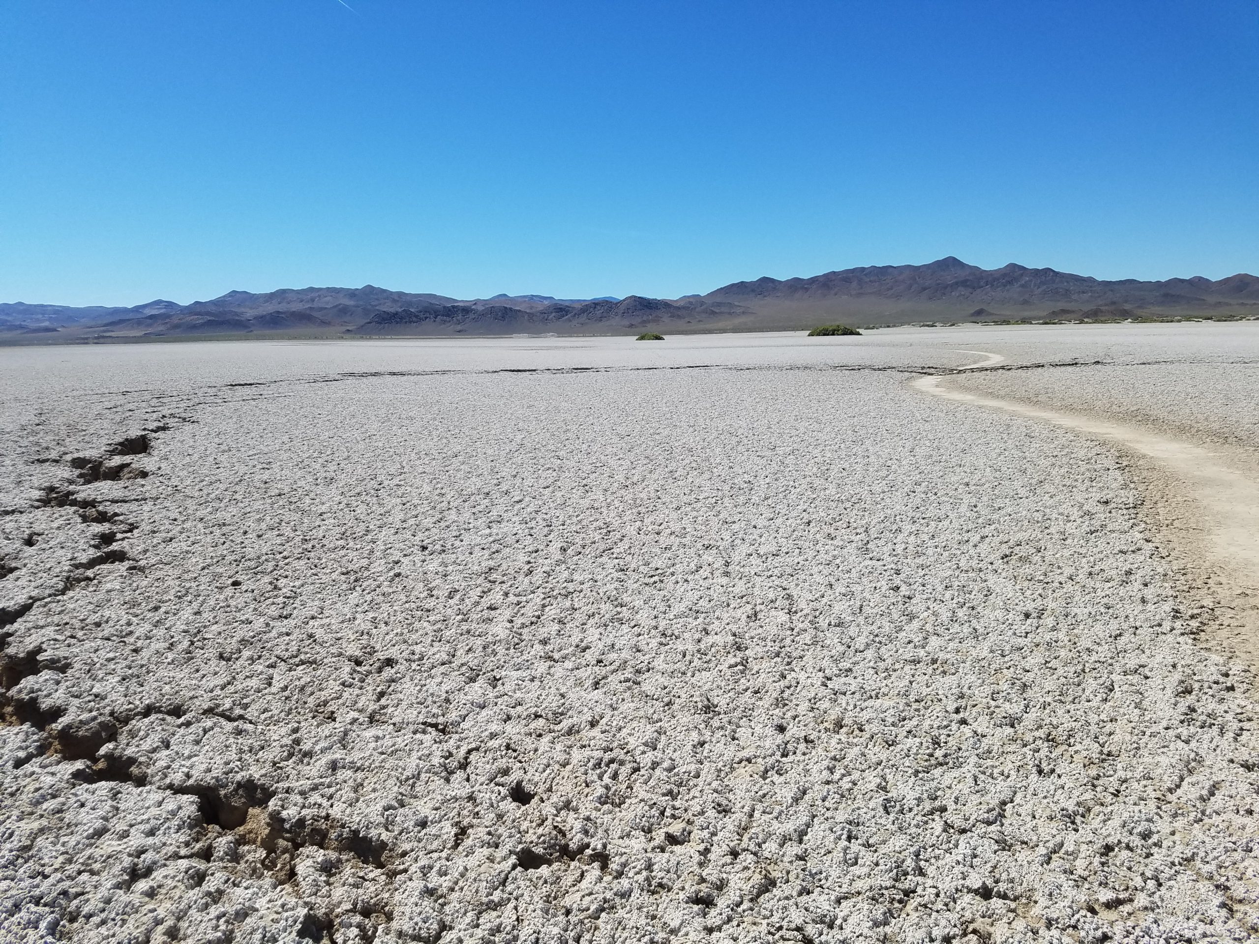
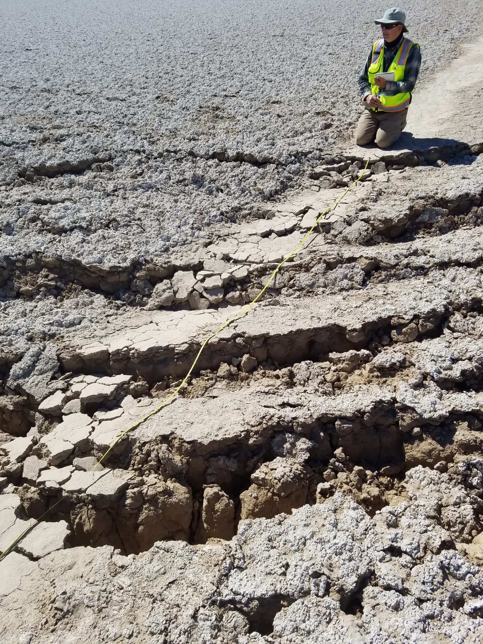
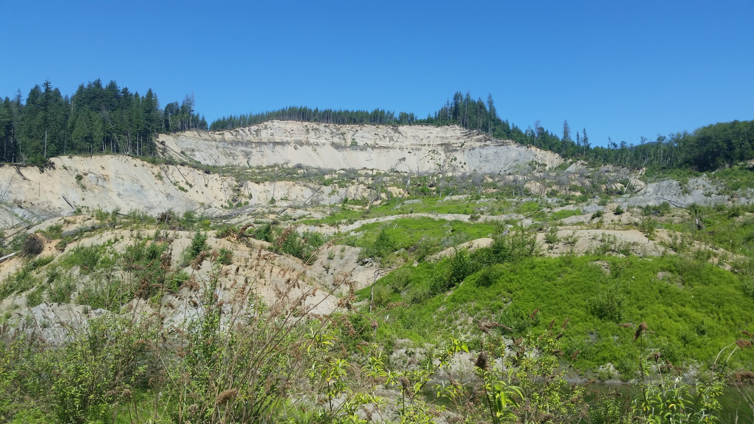
Post-Event Reconnaissance
Experimental and numerical models must have a basis in physical reality. If we are to design models that replicate geotechnical and geologic hazards, we must have accurately measured data from real occurrences of these hazards. Post-event reconnaissance is a primary means of obtaining this data. Through organizations such as the Geotechnical Extreme Events Reconnaissance (GEER) Association, engineers and scientists can retrieve the data necessary to further our understanding of geo-hazards and enhance our resilience against them. The images below are from reconnaissance activities in which Estéfan participated.